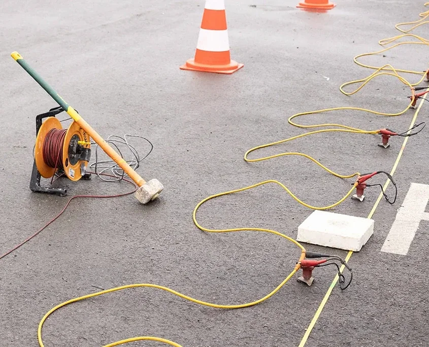
A six-storey mixed-use project on Lonsdale Avenue hit a surprise last fall. The boreholes said till, but excavation revealed a buried channel with soft silt right under the southeast corner. They had to stop work for two weeks. That is exactly the kind of problem a tomographic survey catches before shovels go in. We run seismic refraction and reflection lines across North Vancouver sites to map velocity contrasts in the subsurface—bedrock depth, fracture zones, loose saturated layers. For deeper targets or where traffic noise limits refraction, we switch to reflection acquisition. The output is a continuous P-wave velocity profile, not just points. On a recent Marine Drive job near the mouth of Mackay Creek, the seismic refraction profile picked up a low-velocity lens at 8 m depth that coring alone had missed. We often pair the velocity model with a MASW survey to add shear-wave data for seismic site class, especially where the NBCC 2020 requires Class C or better for essential facilities.
A single seismic line can replace three or four boreholes for bedrock mapping—faster, less invasive, and a continuous profile instead of point data.
Applicable standards
NBCC 2020 – National Building Code of Canada, seismic provisions, CSA A23.3 – Design of concrete structures, foundation references, ASTM D5777 – Standard Guide for Seismic Refraction, ASTM D7128 – Standard Guide for Seismic Reflection, BC Building Code 2024 – provincial adaptation with North Shore geotechnical notes
Frequently asked questions
What does a seismic tomography survey cost in North Vancouver?
Budget between CA$3,390 and CA$7,930 depending on line length, depth target, and whether you need refraction alone or combined refraction and reflection. A short refraction line for a single-family lot starts at the lower end. Multi-line surveys with reflection processing and MASW for site class push toward the upper range. We provide a fixed-price quote after reviewing the site plan and geotechnical brief.
How long does a seismic survey take on site?
A single refraction line of 69 meters takes about two to three hours on site with a two-person crew. Longer lines or reflection spreads with multiple shot points can take a full day. Data processing and interpretation add another three to five business days before you get the final report.
Can you do seismic tomography on a small residential lot?
Yes, we run short refraction spreads on lots as narrow as 15 meters. The key is having enough line length for the target depth—rule of thumb is four to five times the depth you want to image. For a typical North Vancouver single-family lot we usually reach 15–20 meters depth, which covers most foundation concerns.
What is the difference between refraction and reflection tomography?
Refraction uses first-arrival travel times and works best when velocity increases with depth—ideal for bedrock mapping where till overlies faster rock. Reflection uses reflected energy from acoustic impedance contrasts and works even when a low-velocity layer sits below a faster one. In North Vancouver, we use refraction for shallow bedrock and reflection for deep or complex stratigraphy where the water table creates a velocity inversion.
Do I still need boreholes if I have a seismic survey?
Seismic gives you a continuous velocity profile but does not tell you soil type directly—you need at least one borehole or test pit to calibrate the velocity layers to actual lithology. We typically recommend one borehole per seismic line for ground-truthing. The combination gives you the best of both: continuous coverage from geophysics plus material samples from drilling.